Boundaries of BC-Yukon-Alaska, Ontario-Manitoba (1906)

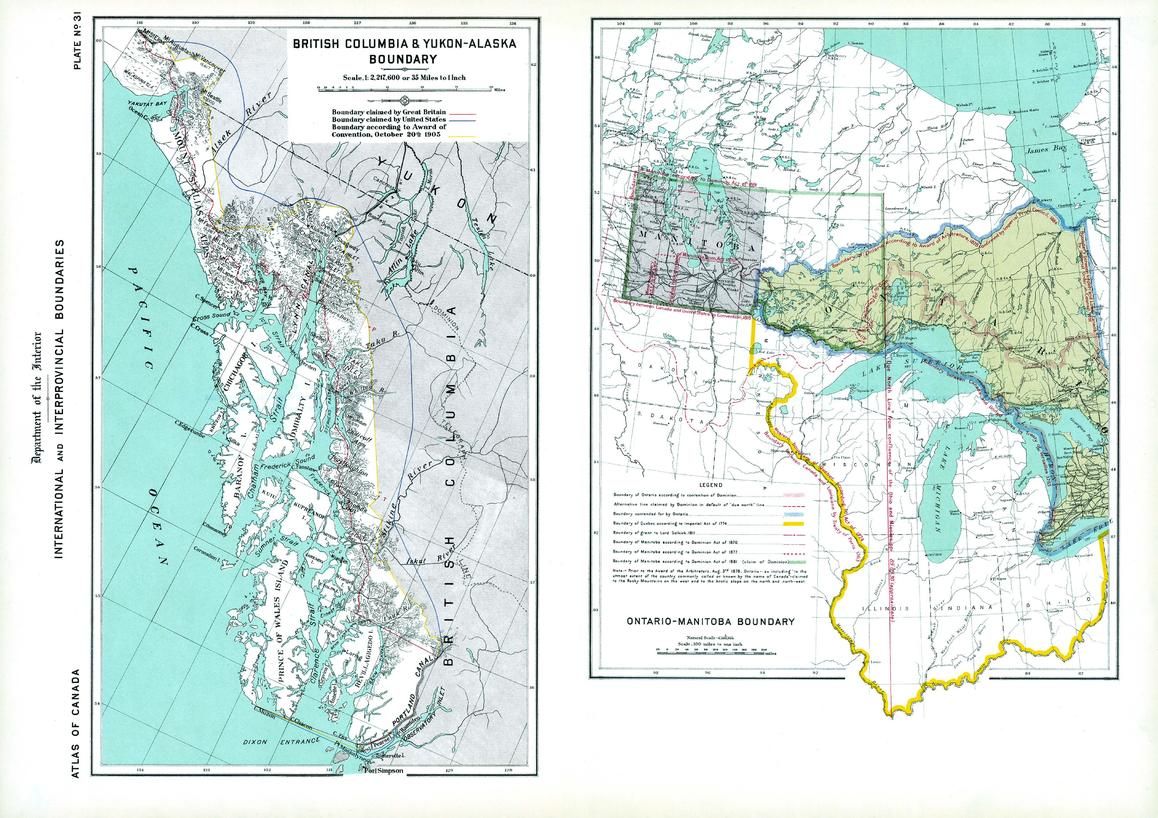
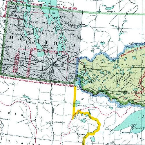
Contained within the 1st Edition (1906) of the Atlas of Canada is a plate that consists of 2 maps illustrating international and interprovincial boundary historical claims up to 1906. One map shows Ontario, Manitoba and adjacent parts of the US. The other map shows the Alaska boundary dispute. British Columbia and Yukon - Alaska boundary map displays the respective disputes of Great Britain and the United States, as well as the awarded boundary announced October 20th, 1905. The Ontario-Manitoba boundary map was concentrated on the contestation of the Dominion and Manitoba disputing the Ontario boundary on the west by prolongation of a due north line from the joining of the Ohio and Mississippi, as well as the height of land between the St. Lawrence and Hudson bay. In addition, major railway systems displayed.
| Width (mm) | 613 |
|---|---|
| Height (mm) | 433 |
| Scale | 1:2,217,600 |
| Brand | NATURAL RESOURCES CANADA |
| Country | Canada |
Dispatch
We pride ourselves on providing a fast, efficient service and therefore we aim to dispatch all orders received before 4:00pm on the same day.
Free Delivery
We offer a free 1st class delivery service on all orders. This gaurantees you a 1-2 day delivery service via Royal Mail.
Need it fast?
we offer a selection of shipping upgrades at the checkout stage.
- Expedited Shipping - Royal Mail 1st Class: FREE
- Next-Day Courier Shipping - 24hr Courier Service: £6.95
The Dash 14 day – ‘No Questions Asked’ Returns Policy
Provided you return the item(s) to us in an unused and resaleable condition along with its original packaging…
We guarantee that if you change your mind for any reason within 14 days of purchase, you are free to return your item(s) to us for exchange or full refund on the product price
Beyond our 'No Questions Asked' period we will of course, happily accept items being returned as a result of damage or packing errors. In each of these cases we will provide you with a freepost address for the return of the item(s).