D-Day - Ste. Marie du Mont - Normandy - Wall Map

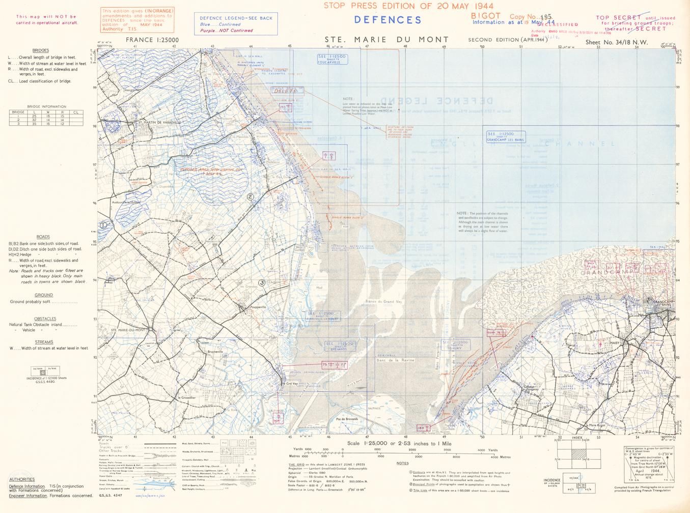
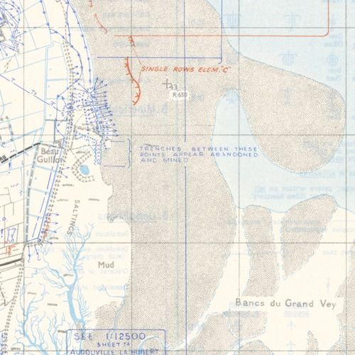
D-Day map dated 19 May, 1944. Covering the area between Utah and Omaha Beaches and the Town of Sainte. Marie du Mont. This Map was produced in the run up to D-Day by the Allies, as they planned the assault on Normandy. The Original Maps have been digitally scanned at high resolution in Full Colour.
| Width (mm) | 717 |
|---|---|
| Height (mm) | 533 |
| Brand | XYZ MAPS |
Dispatch
We pride ourselves on providing a fast, efficient service and therefore we aim to dispatch all orders received before 4:00pm on the same day.
Free Delivery
We offer a free 1st class delivery service on all orders. This gaurantees you a 1-2 day delivery service via Royal Mail.
Need it fast?
we offer a selection of shipping upgrades at the checkout stage.
- Expedited Shipping - Royal Mail 1st Class: FREE
- Next-Day Courier Shipping - 24hr Courier Service: £6.95
The Dash 14 day – ‘No Questions Asked’ Returns Policy
Provided you return the item(s) to us in an unused and resaleable condition along with its original packaging…
We guarantee that if you change your mind for any reason within 14 days of purchase, you are free to return your item(s) to us for exchange or full refund on the product price
Beyond our 'No Questions Asked' period we will of course, happily accept items being returned as a result of damage or packing errors. In each of these cases we will provide you with a freepost address for the return of the item(s).