Pocket Mountains - Brighton And The South Downs
Our Price £6.29 With Free First Class Delivery On All Orders Saving £0.70 (10%)


Pocket Mountains - Brighton and the South Downs
Facing the sea with rolling chalk Downland rising to landward, Brighton & Hove has one of the finest situations of all English cities. Brighton has a long history as a resort town and continues to be phenomenally popular with visitors from London, across South East England and further afield. The beaches, seafront promenades and city centre teem with visitors in the summer months and Brighton has also recently been called ‘the happiest place to live in the UK’, as well as its ‘hippest city’.
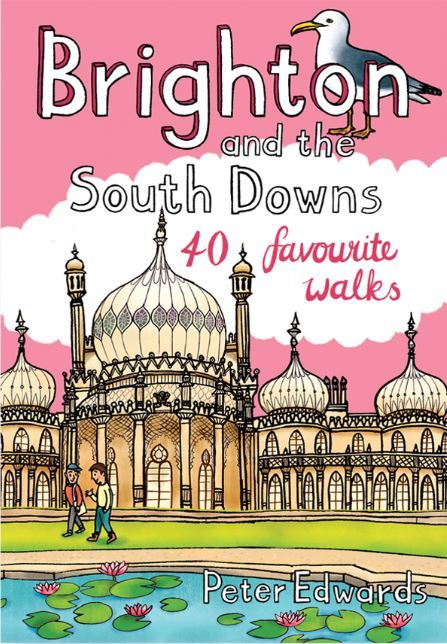
The city has some remarkable architecture, including the famous Royal Pavilion, the grand Regency squares with their imposing terraces and elaborate gardens, the ever-popular Victorian Palace Pier with its funfairs and bright lights and the expansive seafront promenades with the recently erected i360 observation tower. The North Laine and The Lanes areas of town are filled with a dazzling array of independent shops, pubs, cafés and restaurants. The city streets climb the slopes around the valley along which the A23 winds its way to the sea, and parks and gardens of all sizes ensure that nowhere does it feel oppressively urban. Brighton has long been renowned as a centre for the expressive and performing arts, not least for its theatres and live music venues, and it hosts the annual Brighton Festival and the associated Fringe, which takes place at venues throughout Brighton & Hove every May.
The city is home to one of the largest LGBT communities in England. The city’s two universities, Brighton and Sussex, have a combined student population of around 40,000 – a significant slice of the total population of around 295,000. Unsurprisingly, Brighton has a high proportion of younger inhabitants and this is reflected in the city centre’s renowned nightlife with numerous clubs, live music venues and bars. On fine summer evenings the beachfront between the piers has a festival atmosphere.
The South Downs
The ‘blunt, bow-headed, whale-backed Downs’, as Rudyard Kipling famously styled them, are one of England’s most recognisable and best-loved landscapes; a range of chalk hills covering approximately 670 sq km across the coastal counties of Hampshire and Sussex in South East England. In the west the South Downs climb gently from Hampshire’s Itchen Valley through ancient pastures and woodland, giving way to the characteristic rolling chalk Downland with close-cropped turf and dry valleys that extends eastwards to the high chalk cliffs of Beachy Head and the Seven Sisters. The Sussex Downs, as the eastern area of Downland was once known, are bounded on the northern side by a steep escarpment, looking out across the Sussex Weald. Southwards, the spurs and valleys of the dip-slope run gently down to the Channel coast.
As well as the old chalk grasslands, the Downs incorporate a variety of landscapes and habitats, including deciduous, coniferous and mixed woodland, heathland, wetland, shingle beach and saltmarsh. The South Downs National Park (SDNP) is the most extensive, well-used recreational landscape in South East England, containing more than 3200km of public rights of way – footpaths, bridleways and byways. The national park is also a working landscape with arable and livestock farming throughout the Downland. Efforts to find the balance between managing agriculture, restoring natural habitats and mitigating development pressures from population centres saw the South Downs National Park come into being in 2011 with a remit to protect and restore the Downs. The walks in this guidebook cover the area of the Eastern Downs around Brighton, extending to Eastbourne in the east and as far as Worthing and the Findon Valley in the west, and from the Channel coast to the foot of the Downs’ steep northern escarpment at the edge of the Sussex Weald.
Weather
Brighton and the South Downs have a temperate climate characterised by relatively cool summers and cold winters with frequent rain and cloud cover. Rainfall levels increase as the land rises away from the coast. Hot dry spells with temperatures considerably in excess of summer averages are not unknown.
Access and safety
There is a very extensive network of footpaths, bridleways and byways around Brighton and the Downs, which are clearly marked on Ordnance Survey maps and well signposted on the ground. Areas of Access Land are also open to walkers and these are marked on OS maps with a yellow wash and by a magenta wash on the coastal margin. The chalk clifftops along the Channel coast are subject to ongoing erosion, which causes instability and occasional cliff falls, so always keep away from cliff edges. The region’s wildlife is almost entirely benign, but adders are common; their bite can be very painful and cause swelling, bruising and other symptoms. An adder bite can be fatal for dogs. You should also exercise caution entering fields with cattle – the more so if you have a dog and there are calves present.
Getting here and getting around
Part of Brighton’s enduring popularity is its proximity to London – many train services take less than an hour. The eastern part of the Downs – covered in this guidebook – is well-served by public transport and easily-accessible from both London and Brighton. Almost all of the walks in this guidebook start from or near a railway station or are accessible by bus. Cycling is a great way of getting around with many walks a short ride from Brighton or from stations around the eastern Downs.
History
First recorded in the Domesday Book of 1086, the fishing village of Brighthelmstone grew steadily to become the most important and populous town in Sussex by the mid-1600s. However, during the late-17th and early-18th centuries, French raiders and huge storms wrought havoc. The subsequent decline of its fishing industry stifled the town’s economy and the population waned, but from the 1730s the town experienced a remarkable upturn in its fortunes. The contemporary fad for drinking and bathing in seawater as a cure for various illnesses brought visitors to Brighton to ‘take the cure’. Health spas and indoor baths opened and Brighton soon became a fashionable resort town. The arrival of the London and Brighton Railway in 1841 brought Brighton within reach of daytrippers from London, exponentially increasing the number of visitors. Many of the town’s major attractions were built during the Victorian era, including the Grand Hotel, the West Pier and the Palace Pier. Brighton’s population also grew from around 7000 in 1801 to more than 120,000 by 1901.
Brighton’s boundaries continued to grow through the 20th century. Development pressures from the surrounding population centres, including the expansion of Greater Brighton and other urban areas, was one of the primary factors that eventually led to the establishment of the South Downs National Park in 2011. The popular image of the South Downs as rolling chalk grasslands results from many centuries of livestock grazing. This process began with the Neolithic people who settled here some 5000 years ago, raising livestock, clearing woodland and planting crops, and was continued by the peoples of the Bronze Age and Iron Age. The Romans also farmed the Downland, grazing livestock and growing corn. Following the Norman conquest, the populations of villages and towns around the Downs grew considerably and, by the late Middle Ages, the eastern area of the Downs alone supported more than 200,000 ewes and lambs.
Until the mid-20th century, Downland farmers operated an agricultural rotation system known as ‘sheep-and-corn farming’ to improve the soil. However, the Second World War caused vast acreages of grassland to be ploughed for the production of grain. The move to arable farming continued into the 1950s, fundamentally changing the landscape and diminishing biodiversity.
Today the Downs are predominantly a mix of pasture, arable and woodland while the creation of the South Downs National Park has begun the process of preserving these landscapes and restoring lost habitats.
| Series | 40 Favourite Walks |
|---|---|
| Brand | Pocket Mountains |
| Continent | Europe |
| Country | England |
Dispatch
We pride ourselves on providing a fast, efficient service and therefore we aim to dispatch all orders received before 4:00pm on the same day.
Free Delivery
We offer a free 1st class delivery service on all orders. This gaurantees you a 1-2 day delivery service via Royal Mail.
Need it fast?
we offer a selection of shipping upgrades at the checkout stage.
- Expedited Shipping - Royal Mail 1st Class: FREE
- Next-Day Courier Shipping - 24hr Courier Service: £6.95
The Dash 14 day – ‘No Questions Asked’ Returns Policy
Provided you return the item(s) to us in an unused and resaleable condition along with its original packaging…
We guarantee that if you change your mind for any reason within 14 days of purchase, you are free to return your item(s) to us for exchange or full refund on the product price
Beyond our 'No Questions Asked' period we will of course, happily accept items being returned as a result of damage or packing errors. In each of these cases we will provide you with a freepost address for the return of the item(s).