North America Political Wall Map

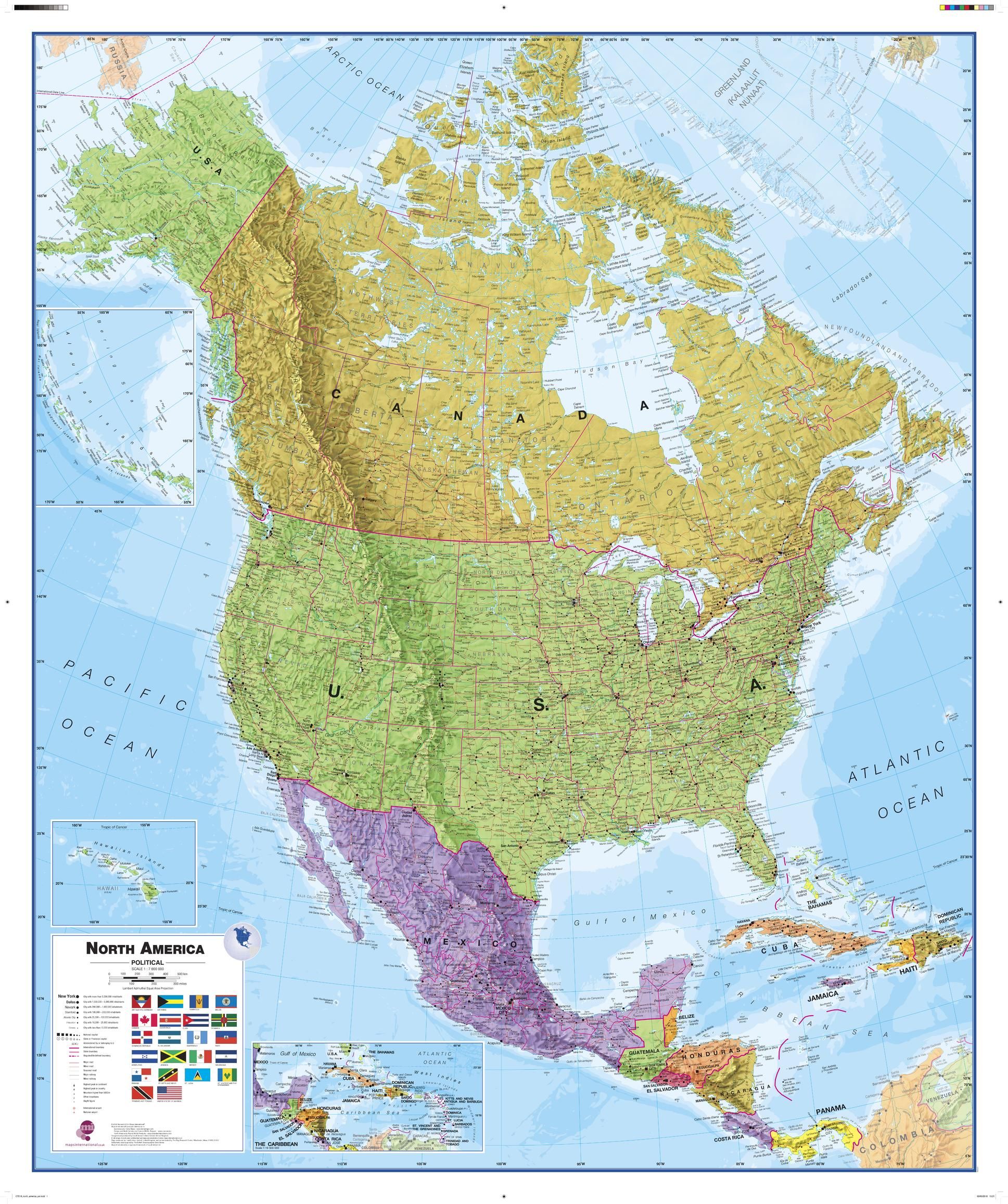
Maps Internationals North America political wall map covers a huge expanse of land from Alaska and Canada through the United States down to Mexico, Central America and the Caribbean. North American political map detail: This political wall map of North America features countries shown in different colours, international boundaries and major transport networks. The wall map also contains a panel of flags relating to the countries shown in this North American continent map. Also shown is city population detail, capital cities and all the major towns and cities in this continent of North America.
| Width (mm) | 1000 |
|---|---|
| Height (mm) | 1200 |
| Scale | 1:7,000,000 |
| Brand | MAPS INTERNATIONAL |
Dispatch
We pride ourselves on providing a fast, efficient service and therefore we aim to dispatch all orders received before 4:00pm on the same day.
Free Delivery
We offer a free 1st class delivery service on all orders. This gaurantees you a 1-2 day delivery service via Royal Mail.
Need it fast?
we offer a selection of shipping upgrades at the checkout stage.
- Expedited Shipping - Royal Mail 1st Class: FREE
- Next-Day Courier Shipping - 24hr Courier Service: £6.95
The Dash 14 day – ‘No Questions Asked’ Returns Policy
Provided you return the item(s) to us in an unused and resaleable condition along with its original packaging…
We guarantee that if you change your mind for any reason within 14 days of purchase, you are free to return your item(s) to us for exchange or full refund on the product price
Beyond our 'No Questions Asked' period we will of course, happily accept items being returned as a result of damage or packing errors. In each of these cases we will provide you with a freepost address for the return of the item(s).