North Circumpolar Region Wall Map - Bilingual - Atlas of Canada

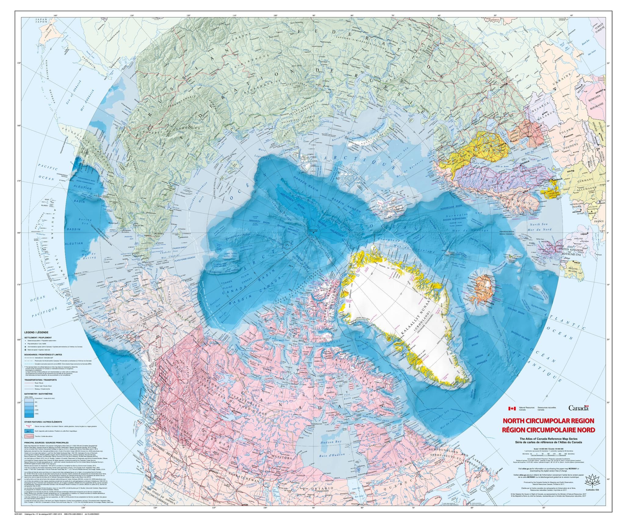
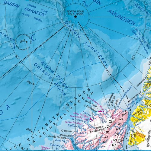
This bilingual map shows the geography of the northern circumpolar region, north of approximately 55 degrees, at a scale of 1:9 000 000. The map uses the azimuthal equidistant projection. It includes all international boundaries, as well as the Canadian provincial and territorial boundaries and Canadas 200 nautical mile offshore exclusive economic zone. National capital cities are shown, as are other cities, towns, villages and hamlets. Some seasonally populated places are also included. The map displays a number of significant northern features, including the median sea ice extent for September 1981 to 2010, the tree line, undersea relief, land relief, the Magnetic North Pole, glaciers, ice fields and coastal ice shelves. Many of the physiographic and hydrographic features are labelled.
| Width (mm) | 1087 |
|---|---|
| Height (mm) | 921 |
| Scale | 1:9,000,000 |
| Brand | NATURAL RESOURCES CANADA |
Dispatch
We pride ourselves on providing a fast, efficient service and therefore we aim to dispatch all orders received before 4:00pm on the same day.
Free Delivery
We offer a free 1st class delivery service on all orders. This gaurantees you a 1-2 day delivery service via Royal Mail.
Need it fast?
we offer a selection of shipping upgrades at the checkout stage.
- Expedited Shipping - Royal Mail 1st Class: FREE
- Next-Day Courier Shipping - 24hr Courier Service: £6.95
The Dash 14 day – ‘No Questions Asked’ Returns Policy
Provided you return the item(s) to us in an unused and resaleable condition along with its original packaging…
We guarantee that if you change your mind for any reason within 14 days of purchase, you are free to return your item(s) to us for exchange or full refund on the product price
Beyond our 'No Questions Asked' period we will of course, happily accept items being returned as a result of damage or packing errors. In each of these cases we will provide you with a freepost address for the return of the item(s).