


Description
DESCRIPTION
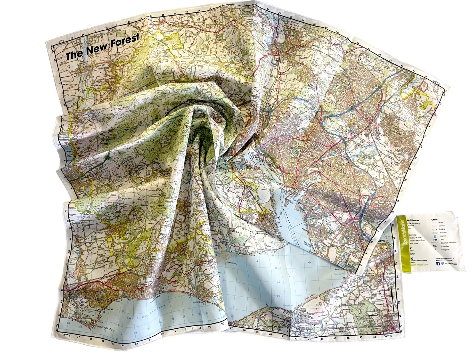
NEW FOREST MAP OF THE NATIONAL PARK
The New Forest Map SplashMap is a beautiful washable, weatherproof, wearable map, covering all of Hampshire’s National Park. Thanks to our unique pro weatherproof, durable fabric it’s the most versatile, unfailing map money can buy. We’ve used the Ordnance Survey Landranger Map so you can be super confident of up to date, detailed and accurate content. All the features you’d expect are super clear- like contours, the OS national grid, visitor attractions, walking and riding trails – so you can plan swiftly on wheels, feet or paddles. Popular symbols like pubs, car parks, churches and campsites mean navigating to your start and endpoints is a doddle. That’s why the New Forest SplashMap enhances your whole outdoors experience.
Ordnance Survey New Forest Map centred on Brockenhurst at 25k here
KEY INFORMATION:
MAJOR SETTLEMENTS AND ATTRACTIONS IN THE NEW FOREST:
Lyndhurst, Lymington, Totton, Hythe and Southampton, Barton on Sea, New Milton, Buckler’s Hard, Totton, Southampton, Woodgreen, Godshill, North Street, Pound Bottom, Nomansland, West Wellow, Ower, East Wellow, Canada, Bramshaw, Paultons Golf Course, Paultons Park, North Baddesley, Rownhams, Chilworth, Valley Park, M27, M3, Nursling, Redbridge, Shirley, Bevois Valley, River Test, Lords Hill, Dymer’s Wood, Calmore, Testwood, Bartley, Cadnam, Brook, Sandy Balls, Hyde, South Gorley, Rockford, Ogdens, Bolderwood, Emery Down, Portuguese Fireplace, Bank, Marchwood, Deerleap Inclosure, Dibden, Beaulieu, Exbury, Brockenhurst, Hollands Wood, Balmerlawn, Rhinefield, Hightown, Burley, Highcliffe, Hinton Admiral, Barton on Sea, Milford on Sea, Ringwood, Downton, White Parish, Christchurch, Hengisbury Head, Cowes, Yarmouth, Calshot, Fawley, Lepe Country Park, Parkhurst Forest, Eastleigh, Bishopstoke, Chandlers Ford, Sway – everything covered by the New Forest National Park Authority.
new-forest-splashmap-ordnancesurvey-50k-scale
The SplashMaps New Forest Map is an Ordnance Survey 1:50 000 scale Landranger on our best adventure proof, weatherproof fabric
National Grid Coordinates (Easting, Northing / Grid Reference):
Lower-left – 415500, 089700
Upper-right – 449700, 124200
Scale:
1:50,000
Dimensions on map:
34.5km x 34.5km
Size of product (including borders):
72cm x 72cm (approximately)