
Description
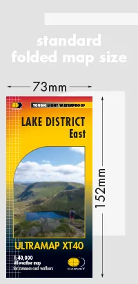
Harvey Ultra Map XT40 – Lake District East
1:40,000 Scale
40 years’ experience have gone into HARVEY’s most creative new series. Slim and light, the Ultramap covers a large area and yet is handily compact. Pocket perfect!
Features Helvellyn, High Street and fells east of the Kendal-Keswick road. The Kirkstone Pass, Ullswater, Haweswater and Kentmere are on this sheet.
Includes 82 Wainwrights.
- The Ultramap covers a large area yet is small enough to slip in a pocket
- The Ultramap is fully detailed genuine original HARVEY mapping.
- The Ultramap is tough and 100% waterproof. Use it without a map case, whatever the weather!
- To provide the biggest area on the smallest lightest sheet, the Ultramap is printed double sided.
- The ingenious folding pattern allows you to open the Ultramap directly to any part, and either side, of the sheet
- The two sides are aligned, so when you reach the edge of the Ultramap sheet you simply flip it over without re-folding. There’s an overlap as well, so you can map read continuously
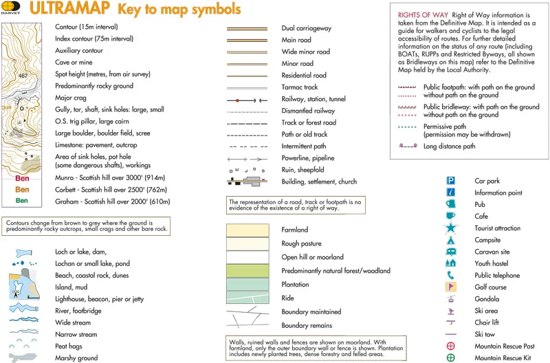
- The magic scale of 1:40,000 enables the Ultramap to provide all the detail you would expect to find on a large scale walking map, including rights of way and boundaries
- Plastic pocket for protection
Confidence
- Ultra tough
- Ultra light
- Ultra compact
- 100% waterproof
Quality
- No compromise – original HARVEY mapping for sure navigation
- Opens directly to any part, and either side, of the sheet
- National Grid for reference
Value
- Large area in handy format
- Built to cope with rough conditions
- Weighs just 25g