

Description
Cicerone – National Trail – Walking The Pennine Way
Britain’s oldest, toughest and best-known long-distance footpath, the Pennine Way stretches 427km (266 miles) from Edale in Derbyshire to Kirk Yetholm in the Scottish Borders. Suitable for walkers with some experience, England’s most challenging National Trail can be walked in 3 weeks.
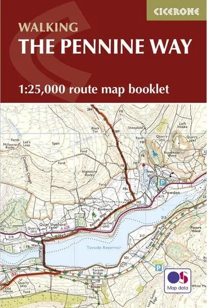
This map booklet contains all the OS 1:25,000 Explorer mapping you need to complete the Pennine Way National Trail, saving the space, weight and expense of multiple map sheets. Conveniently sized to slip in a jacket pocket or rucksack top, it comes in a clear PVC sleeve.
The full route is shown on 1:25,000 OS maps
Highlights along the trail include Kinder Scout, Black Hill, Stoodley Pike, Malham Cove, Pen-y-Ghent, High Cup, Hadrian’s Wall, Cheviot Hills
The map booklet can be used to walk the path in either direction
It is conveniently sized for slipping into a jacket pocket or top of a rucksack