

Description
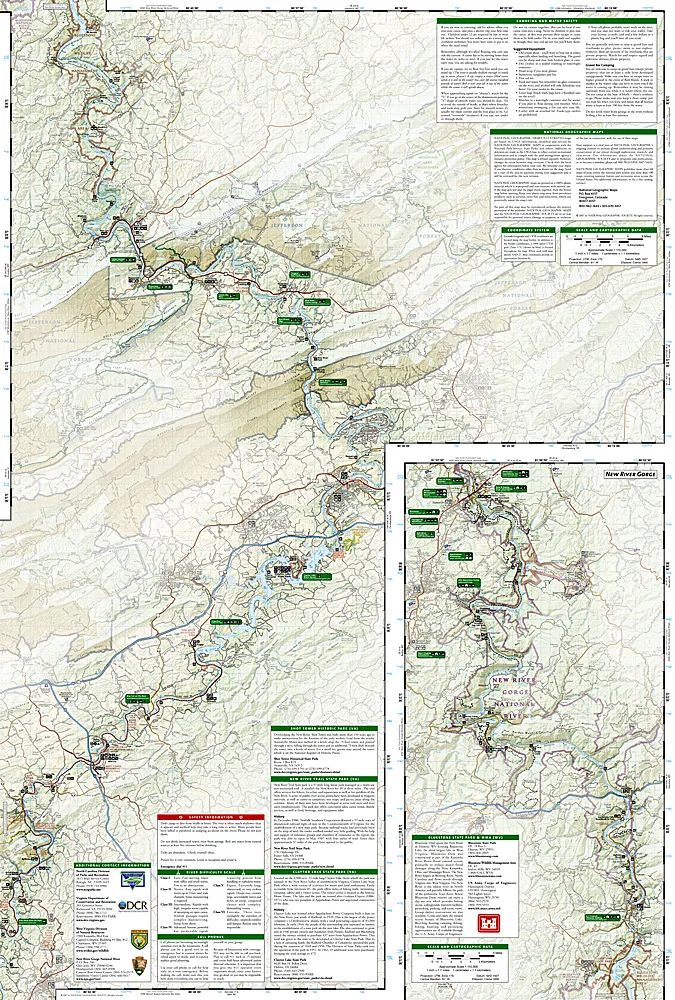
Scale = 1:110,000
More than just a map, National Geographic Trails Illustrated topographic maps are designed to take you into the wilderness and back. Printed on tear-resistant, waterproof material, this map can go anywhere you do. Each map is based on exact reproductions of USGS topographic map information, updated, customized, and enhanced to meet the unique features of each area. The maps include valuable wilderness tips and Leave No Trace guidelines, along with updated trails, trailheads, points of interest, campgrounds, and much more. With a new color palette and stunning shaded relief, backcountry navigation has never been easier.
Created in partnership with local land management agencies, this expertly researched map highlights key areas of interest including Mount Jefferson State Natural Area; New River Trail State Park; Shot Tower Historic Park; and New River, Bluestone, and Claytor Lake state parks. A detailed inset of New River Gorge is provided in the print version of this map.Whether you’re hiking portions of the Appalachian and New River trails, riding the Virginia Highlands Horse Trail, or traveling on the river itself, you’ll find trails clearly marked to keep you on the right path.