

Description
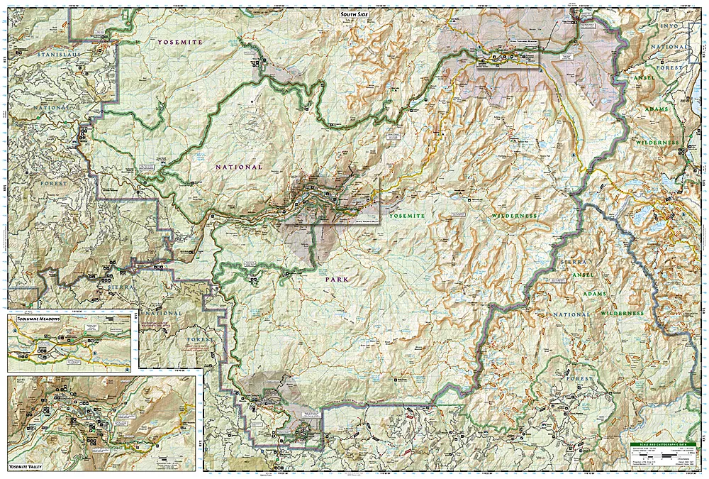
•Approximately 4 1/4″ x 9 1/4″ folded; 25 1/2″ x 37 3/4″ fully opened
•Scale = 1:80,000 & 1:40,000
Coverage includes: Stanislaus National Forest, Toiyabe National Forest, Inyo National Forest, Sierra National Forest Emigrant Wilderness, Carson Iceberg Wilderness, Hoover Wilderness, Yosemite Wilderness, and Ansel Adams Wilderness with detail on Yosemite Valley and Tuolumne Meadows. Also provides UTM grids for use with your GPS unit.
Printed on tear-resistant, waterproof material, this map can go anywhere you do. Each map is based on exact reproductions of USGS topographic map information, updated, customized, and enhanced to meet the unique features of each area. The maps include valuable wilderness tips and Leave No Trace guidelines, along with updated trails, trailheads, points of interest, campgrounds, and much more. With a new color palette and stunning shaded relief, backcountry navigation has never been easier.