
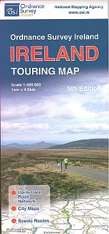

Description
Ordnance Survey – Ireland Touring Map
Scale 1:450,000 (1cm = 4.5km)
For those who like their mapping to be easy to read and uncluttered. The Ireland Map Series Touring Map is a map of the whole of Ireland, showing all of the roads clearly, along with place names. The background is white, with roads marked on in different colours according to grade. Ferry ports, routes and destinations are also clearly marked as are railways and stations. Road distances are given mid way between junctions, and road numbers are all present. Information which is not relevant to touring is cut down to a bare minimum, allocating space for as much route detail and road information as possible. Enlarged transit map insets of the routes through and around main cities and towns are shown too, and a driving distances calculator table is present at the bottom of the map.
Featuring: Detailed road network, holiday information, scenic routes and city maps. Includes index to cities, towns & villages.