
Description
Ordnance Survey Isle of Skye – Pathfinder Guide 3
Outstanding Circular Walks – 1:25,000 Scale
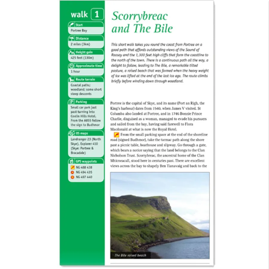
This Ordnance Survey Pathfinder guide covers a substantial area of Scotland’s western seaboard. The walks divide simply into mountain and coastal routes. A cliff-top walk starting at Stoer gives stunning views of Quinag and Ben More and the Outer Hebridean islands, while another route starts from Shieldaig, a picturesque village facing west towards the Applecross peninsula.
Each of Ordnance Surveys OS Pathfinder guides feature a total of 28 circular routes varying in length and difficulty and have all been tried and tested by seasoned walkers. The routes range from extended strolls to exhilarating hikes, so there is something for everyone.
Contains:
- Clear, large scale Ordnance Survey mapping;
- 28 great country walks from 2 to 11 miles;
- GPS references for all route waypoints;
- details of refreshment stops and parking;
- walking safety advice; and
- information about walkers and the law.