The Dividing Link, Mexico and Central America - Published 2007

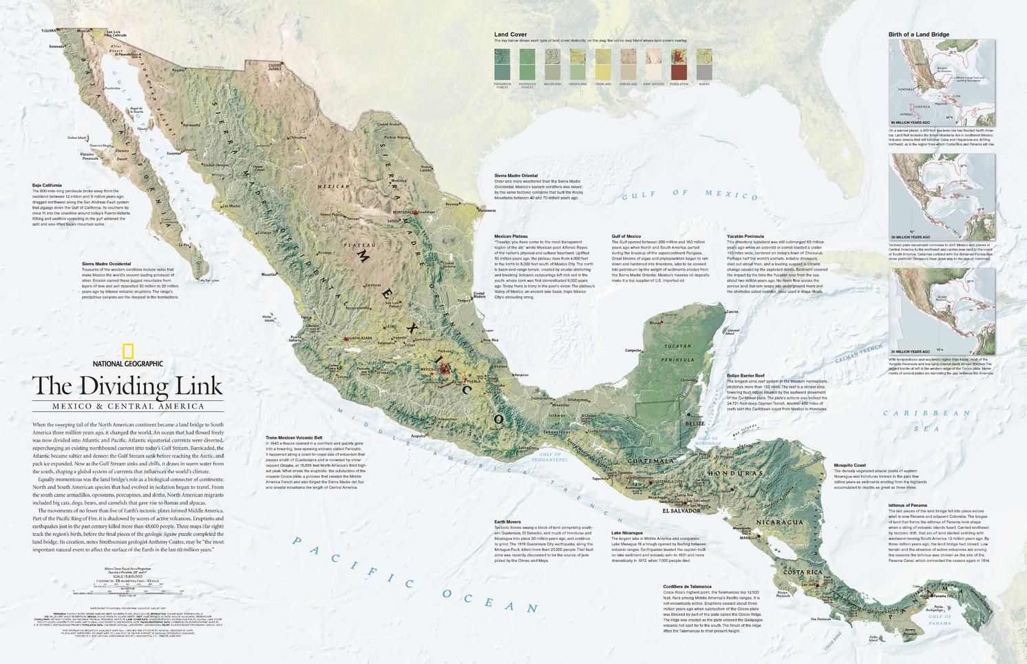
When the sweeping tail of the North American continent became a land bridge to South America three million years ago, it changed the world. An ocean that had once flowed freely was now divided into Atlantic and Pacific. Its effect on ocean currents influenced the worlds climate and the land bridge became a biological connector as well when species that had developed in isolation began to travel between continents. This detailed physical map of Mexico and Central America includes three maps which track the regions birth, before the final pieces of the geologic jigsaw puzzle completed the land bridge. Published in August 2007, this map was half of a two-map set with a political map of Mexico and Central America.
| Width (mm) | 790 |
|---|---|
| Height (mm) | 510 |
| Scale | 1:5,810,000 |
| Brand | NATIONAL GEOGRAPHIC |
Dispatch
We pride ourselves on providing a fast, efficient service and therefore we aim to dispatch all orders received before 4:00pm on the same day.
Free Delivery
We offer a free 1st class delivery service on all orders. This gaurantees you a 1-2 day delivery service via Royal Mail.
Need it fast?
we offer a selection of shipping upgrades at the checkout stage.
- Expedited Shipping - Royal Mail 1st Class: FREE
- Next-Day Courier Shipping - 24hr Courier Service: £6.95
The Dash 14 day – ‘No Questions Asked’ Returns Policy
Provided you return the item(s) to us in an unused and resaleable condition along with its original packaging…
We guarantee that if you change your mind for any reason within 14 days of purchase, you are free to return your item(s) to us for exchange or full refund on the product price
Beyond our 'No Questions Asked' period we will of course, happily accept items being returned as a result of damage or packing errors. In each of these cases we will provide you with a freepost address for the return of the item(s).