British Isles - Published 1949

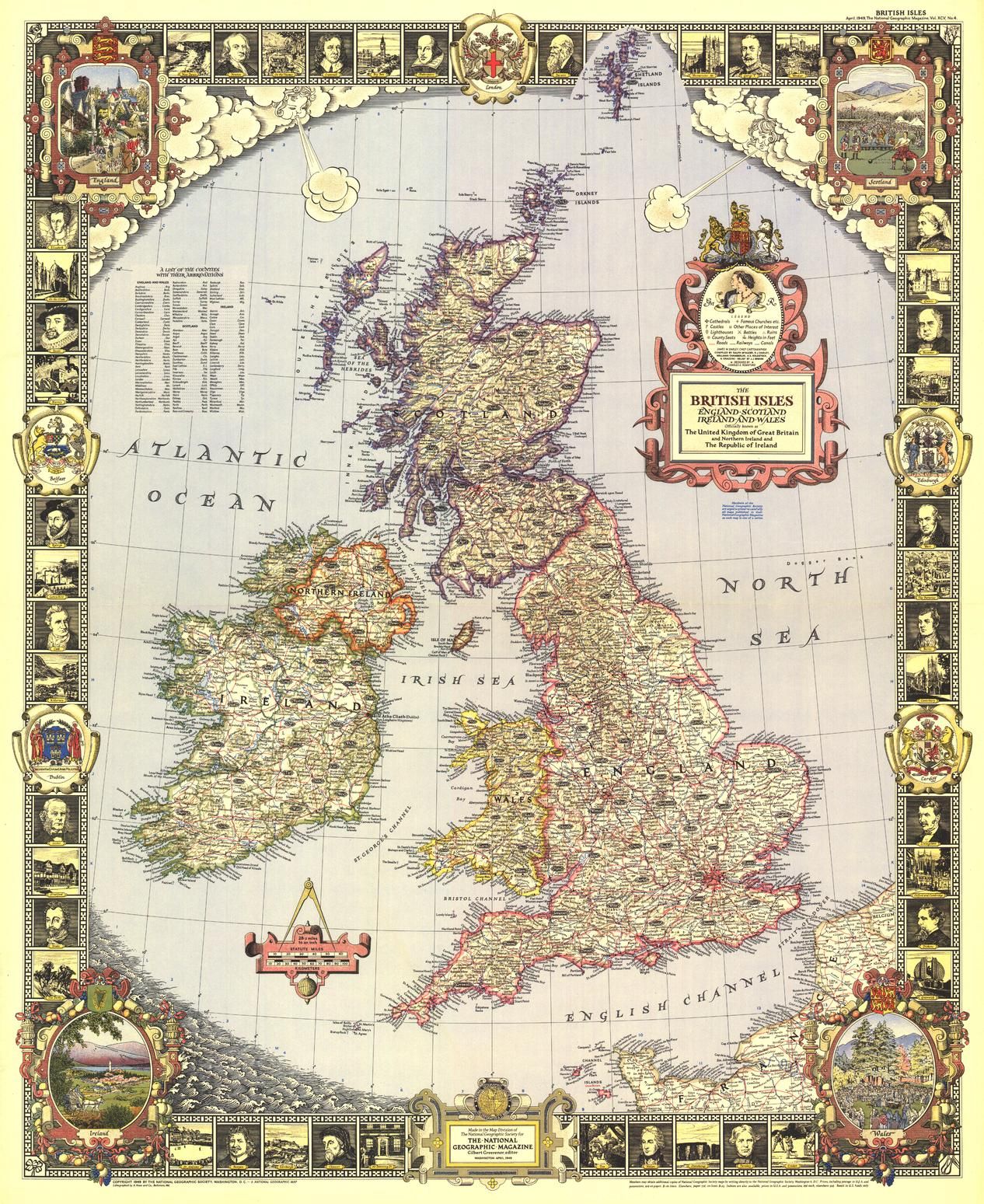
With its elaborate, illustrated border and stylish legend, this map of the British Isles was made for framing. Published in April 1949, it is both a work of art as well as an informative map, containing an abundance of places of interest including cathedrals, ruins, battlefields, and more.
| Width (mm) | 670 |
|---|---|
| Height (mm) | 820 |
| Scale | 1:1,786,752 |
| Brand | MAPS INTERNATIONAL |
Dispatch
We pride ourselves on providing a fast, efficient service and therefore we aim to dispatch all orders received before 4:00pm on the same day.
Free Delivery
We offer a free 1st class delivery service on all orders. This gaurantees you a 1-2 day delivery service via Royal Mail.
Need it fast?
we offer a selection of shipping upgrades at the checkout stage.
- Expedited Shipping - Royal Mail 1st Class: FREE
- Next-Day Courier Shipping - 24hr Courier Service: £6.95
The Dash 14 day – ‘No Questions Asked’ Returns Policy
Provided you return the item(s) to us in an unused and resaleable condition along with its original packaging…
We guarantee that if you change your mind for any reason within 14 days of purchase, you are free to return your item(s) to us for exchange or full refund on the product price
Beyond our 'No Questions Asked' period we will of course, happily accept items being returned as a result of damage or packing errors. In each of these cases we will provide you with a freepost address for the return of the item(s).