Boundaries of Eastern Canada, San Juan Water Boundary (1906)

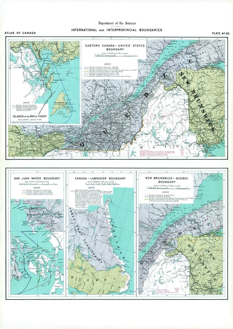
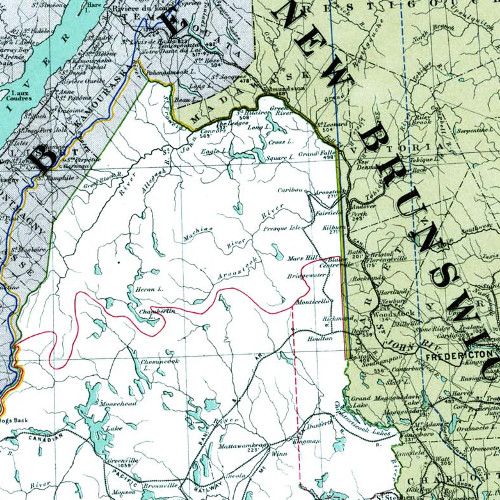
Contained within the 1st Edition (1906) of the Atlas of Canada is a plate that shows five maps illustrating international and interprovincial boundary claims. Two show the Quebec - New Brunswick - Maine area, and another displays the Canada - Labrador boundary. There are two small maps showing offshore claims; one for the Bay of Fundy, and the other for the Gulf Islands (San Juan) in the Strait of Georgia. The Eastern Canada- United States boundary was commonly called the Marine boundary from 1783 to 1842. There were still many disputes going on at the time, including jurisdiction of Newfoundland, the province of New Brunswick - Quebec and the United States, as well as Vancouver Island. The boundary indicating the Labrador coast was to be claimed by Canada. In addition, major railway systems displayed.
| Width (mm) | 433 |
|---|---|
| Height (mm) | 612 |
| Scale | 1:2,217,600 |
| Brand | NATURAL RESOURCES CANADA |
| Country | Canada |
Dispatch
We pride ourselves on providing a fast, efficient service and therefore we aim to dispatch all orders received before 4:00pm on the same day.
Free Delivery
We offer a free 1st class delivery service on all orders. This gaurantees you a 1-2 day delivery service via Royal Mail.
Need it fast?
we offer a selection of shipping upgrades at the checkout stage.
- Expedited Shipping - Royal Mail 1st Class: FREE
- Next-Day Courier Shipping - 24hr Courier Service: £6.95
The Dash 14 day – ‘No Questions Asked’ Returns Policy
Provided you return the item(s) to us in an unused and resaleable condition along with its original packaging…
We guarantee that if you change your mind for any reason within 14 days of purchase, you are free to return your item(s) to us for exchange or full refund on the product price
Beyond our 'No Questions Asked' period we will of course, happily accept items being returned as a result of damage or packing errors. In each of these cases we will provide you with a freepost address for the return of the item(s).